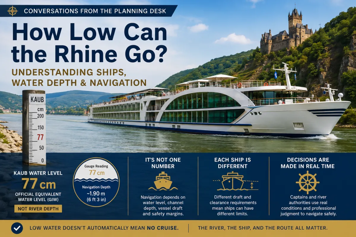
How Low Can the Rhine Go? Understanding Ships, Water Depth & Navigation
Conversations from the Planning Desk
How Low Can the Rhine Go? Understanding Ships, Water Depth & Navigation
In Part 1 of this series, we tackled one of the biggest misunderstandings surrounding Rhine river levels:
A Kaub gauge reading is not the same thing as the depth of the river.
We also established something equally important:
There isn't one universal Kaub number at which every river cruise ship has to stop.
So that raises another question.
How do ships actually operate when river levels get low?
The answer starts with understanding that river ships are designed specifically for the waterways they navigate.
🚢 Aren't Ships Designed With River Depth in Mind?
Yes.
This is an important part of the story that often gets lost when discussing low water.
Navigation authorities establish reference water levels and navigation-channel requirements. Ships operating these waterways must function within the physical constraints of the rivers they're designed to navigate.
The Rhine's Equivalent Water Level is intentionally a low-water reference, not an average river level.
Under the previous EWL methodology, CCNR described this critical low-water level as normally exceeded on at least 95% of days per year.
The current 2022 EWL definition is more precise: it represents an equivalent low-water flow that falls below the long-term average for 20 ice-free days per year.
In other words:
The navigation system is designed with low-water conditions in mind.
Low water itself doesn't automatically mean the Rhine has suddenly become unnavigable.
📏 Gauge Level and Navigation Depth Are Not the Same Thing
This distinction is critical.
When Kaub is reported at 77 cm, that is a reading relative to the established gauge reference.
It does not mean the ship has only 77 cm of water beneath it.
At Kaub's low-water reference, the corresponding navigation-channel depth is approximately 1.90 meters—or about 6 feet 3 inches.
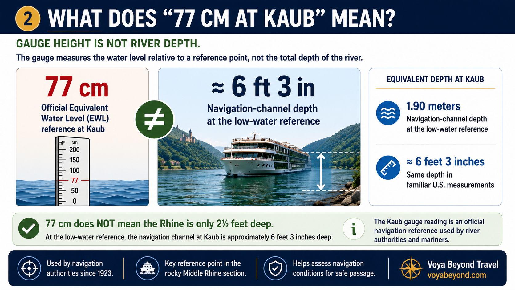
This is why looking at a river-level headline without understanding what the measurement represents can create unnecessary alarm.
🟢🟡🔴 What Happens as the Gauge Drops?
The official Equivalent Water Level (GlW) at Kaub is 77 cm.
When the gauge falls below that reference, available navigation depth decreases.
But that doesn't create an automatic universal shutdown of Rhine navigation.
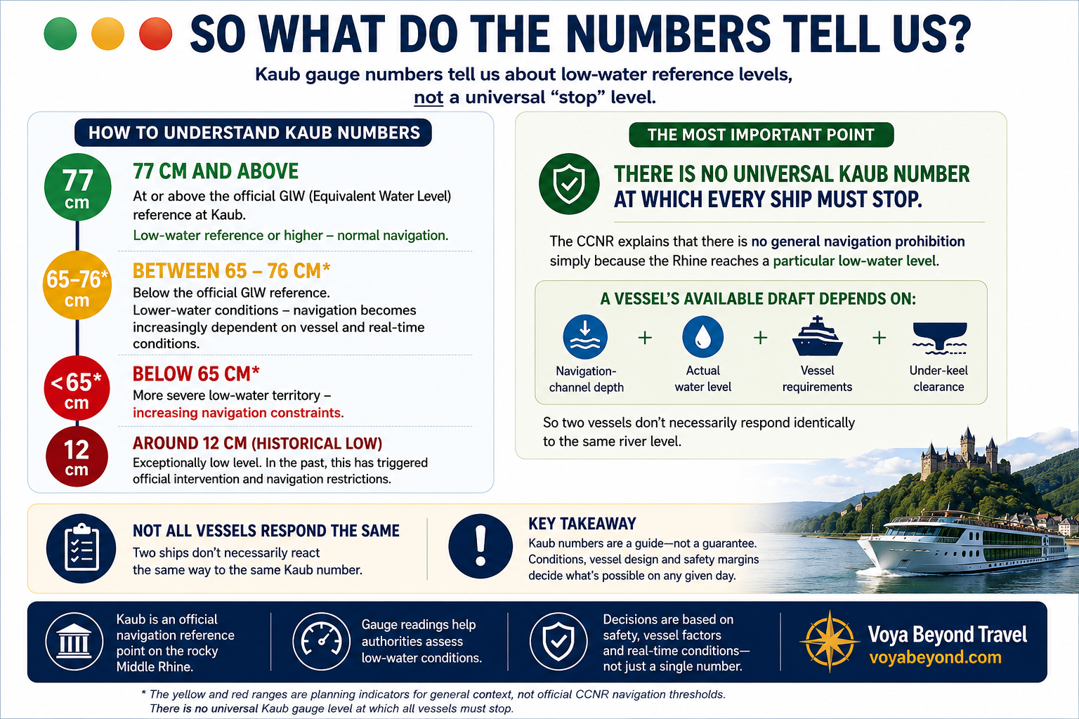
The 65–76 cm and below-65 cm ranges shown in this graphic are planning indicators, not official CCNR navigation thresholds.
They're useful for putting progressively lower readings into context—but they should never be interpreted as universal “go” and “stop” numbers for every vessel.
There is no universal Kaub number at which every ship must stop.
The CCNR explains that reaching a particular low-water level does not automatically create a general prohibition on navigation.
Instead, the question becomes increasingly vessel-specific.
⚓ Why One Ship May Sail When Another Cannot
Whether a vessel can continue depends on several factors working together:
Navigation-channel depth + actual water level + vessel requirements + under-keel clearance
A ship needs sufficient water not simply to float, but to navigate with an appropriate safety margin beneath the vessel.
That is why two vessels facing the same Kaub gauge reading can make different operational decisions.
Their dimensions, loading, draft and other operating requirements may be different.
And that's an important distinction for river cruise travelers.
A headline telling you the Rhine has reached a particular level doesn't necessarily tell you what your ship will do.
🗺️ Geography Matters Too
The Rhine isn't equally deep everywhere.
The Middle Rhine contains a rocky section where navigation depth can become particularly important during periods of low water.
Germany's Federal Institute of Hydrology specifically identifies Kaub's location in this rocky section as one reason the gauge is so significant for Rhine navigation.
So before applying a Kaub reading to a particular river cruise, there is another question to answer:
Does the itinerary actually travel through that section of the Middle Rhine?
Not every cruise marketed as a Rhine itinerary travels the same route.
That means the operational significance of Kaub can vary depending upon the itinerary.
👨✈️ Who Actually Decides Whether the Ship Can Continue?
This is where travelers sometimes want a definitive number:
“At what Kaub reading will my ship stop?”
But river navigation doesn't work quite that simply.
Operational decisions have to account for the actual river conditions, the vessel's characteristics and the safety margins required for navigation.
As conditions become more restrictive, those vessel-specific considerations become increasingly important.
Ultimately, the people operating the vessel have to determine whether conditions allow the ship to continue safely.
That's why I would be cautious of anyone giving travelers a single unofficial Kaub number and saying:
“Above this your cruise is safe; below this your cruise stops.”
The river, the ship and the route all matter.
🚢 What This Means for River Cruise Travelers
The important question isn't:
“What is the lowest Kaub number a river cruise ship can handle?”
A better set of questions is:
Where is my ship sailing?
What are the actual navigation conditions along that route?
How are those conditions trending as my sailing approaches?
And what operational decisions is the cruise line making for that particular vessel?
Those questions give us much more useful information than trying to establish one universal number for every ship.
Why This Matters When Comparing River Cruise Ships
River cruise companies sometimes describe their vessels as having characteristics that help them operate effectively in varying river conditions.
Those characteristics can matter.
But unless a cruise line publishes a specific operating threshold for a particular vessel, I wouldn't convert a marketing claim into a guaranteed Kaub number.
Instead, I look at the complete picture:
The itinerary + river section + vessel + navigation depth + current conditions.
That gives travelers useful context without pretending we can predict an operational decision that ultimately belongs to the people navigating the ship.
The Bottom Line
Low water does not automatically mean no water.
Crossing an official low-water reference does not automatically mean navigation stops.
And a particular Kaub gauge reading does not automatically tell us what every river cruise ship will do.
The lower the river becomes, however, the more important vessel requirements, available navigation depth and appropriate safety margins become.
That's why real-time information matters.
Continue to Part 3
There's still another piece of the Rhine water-level story.
Is low water something new?
Not at all.
The Rhine has a long history of major low-water events—including an extraordinary event in 2018.
But historical low water doesn't mean climate change should be dismissed either.
In Part 3, we'll look at the historical record, what an extreme Rhine year actually looks like, seasonal patterns, the question of the “best” month to cruise and what climate projections tell us about the future.
Rhine Water Levels: History, Seasons & Climate Change
From the Planning Desk
Understanding river cruising requires looking beyond a single water-level number.
The characteristics of the river, route and vessel all matter.
That's why when a traveler asks me about water levels, I prefer to look at the itinerary they're actually considering rather than simply telling them whether today's Rhine level is “good” or “bad.”
If you're considering a Rhine river cruise and want help evaluating a particular itinerary, that's a conversation I'm happy to have.
Brandon Sams
Travel Consultant
European River Cruise Specialist (ERCS)
650-541-9409